fbpx

Explore Iceland – Photography Tour

Explore Iceland – Photography Tour

Call for Price

Description

An exclusive opportunity to explore Iceland and be immersed in the natural beauty of this fascinating and unique island, on this 13-day stunning landscape photography tour and workshop with renowned landscape photographer and teacher, Glenn Guy.

Hosted and photography instruction by Glenn Guy. MA (Photography). Accompanied by experienced local tour leader.

ABOUT GLENN GUY

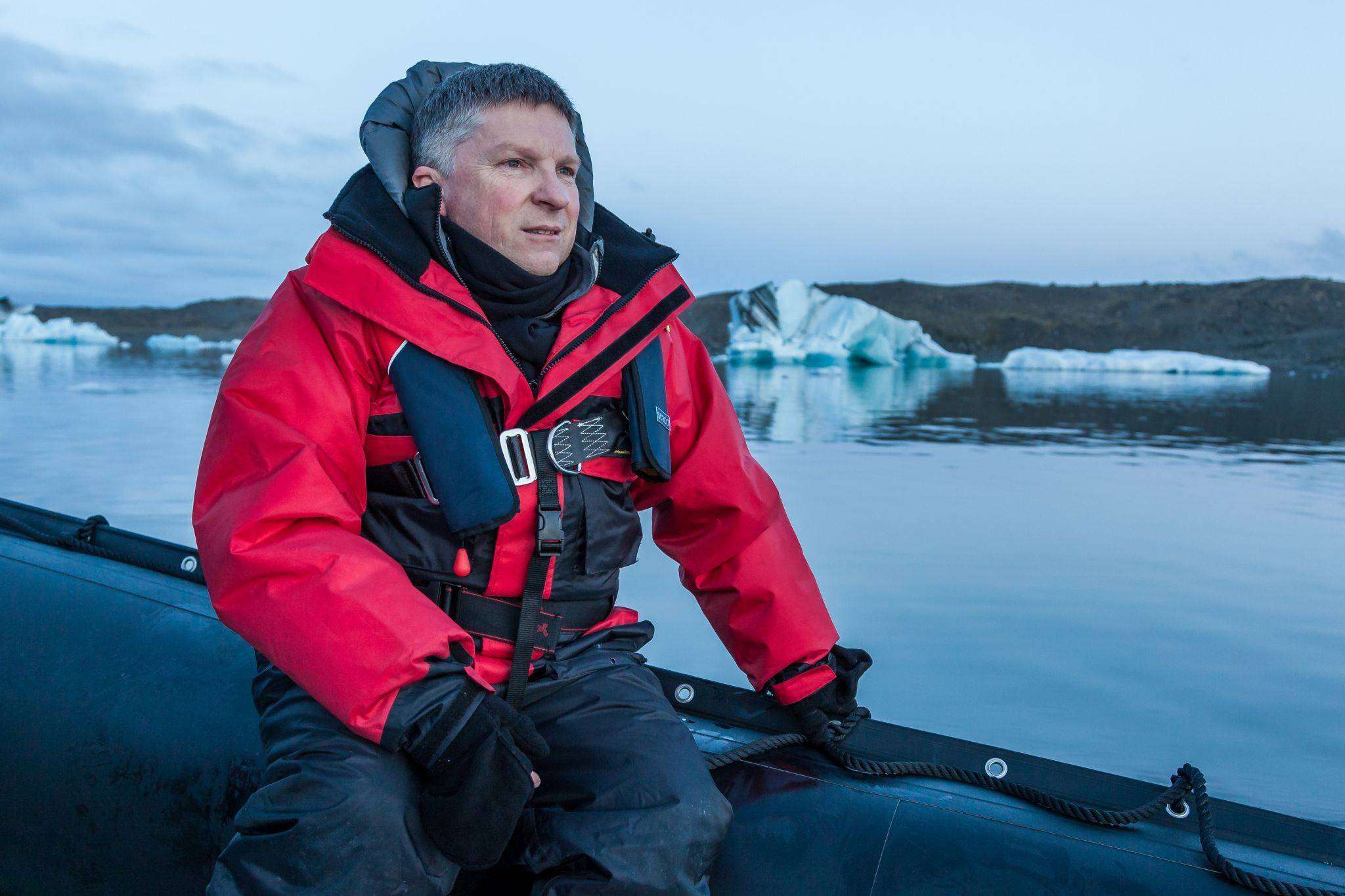
Glenn Guy is a photographer and educator with over 35 years’ industry experience. He is the primary author and publisher of the Travel Photography Guru website and blog, a site dedicated to sharing the beauty of the world and it’s people with an ever-larger audience.

Glenn’s diverse career includes wedding/portrait, publishing, film stills and 8 years at Kodak, including technical specialist and product management roles. He obtained a Master of Arts (Photography) at RMIT University in Melbourne and has lectured extensively at short course and tertiary level.

Glenn is an experienced workshop leader and tutor.

A traveller since 1988, Glenn has undertaken photography expeditions to 6 continents.

Trip Name

Itinerary

ARRIVE REYKJAVIK Day 1/Night 1August 12, 2016

Welcome to Reykjavik, the largest city of Iceland with a population of approximately 120,000.  Reykjavik is the world’s northernmost capital of a sovereign state. Over 60% of the populations live in Reykjavik greater area consisting of six towns, which border with Reykjavik.

Transfer to hotel (transfers can be arranged upon your request).

To foster a quick recovery from your flight and stimulate your creative vision, Glenn Guy, your expert photography guide, will be undertaking an afternoon Reykjavik City Photo Walk for all those able to attend.

We’ll all meet in the evening for a tour introduction and briefing after which there are many dining options available in the capital to avail yourself of.


REYKJANES PENINSULA – Day 2/Night 2August 13, 2016

Situated on an active volcanic ridge the Mountain Hengill Geothermal Area is one of the largest high-temperature fields in Iceland. Our visit will include either the Nesjavellir geothermal Power Plant or the Hellisheidi geothermal power plant and its surroundings. Close to the capital these rugged and colorful areas provide lots of opportunities for great photos.

Cross a footbridge between two continents on the lava scarred Reykjanes peninsula, situated on the Mid-Atlantic ridge. Craters and an old lighthouse are two possible sites to explore and photograph.

Krysuvik is a striking landscape where we’ll view dramatic red, green and yellow colored hills framing an expanse of steaming volcanic vents and hot springs. Just a few minutes drive away are the stunning Krÿsuvíkurberg Cliffs, home to thousands of seabirds.


THE GOLDEN CIRCLE – THINGVELLIR – GEYERS – GULLFOSS Day 3/Night 3 – August 14, 2016

Today we drive inland to the Thingvellir World Heritage Area, where the world’s first democratic parliament meeting took place in 930 AD. The area became Iceland’s first National Park in 1928 and a World Heritage area in 2004.

Sitting right on top of the continental divide, between the North American and Eurasian Plates, this is the best place in Iceland to see the continental drift. The floor of the rift valley has sunken some 60-70 metres with the fissures and fault lines very clear in the landscape on either side of the valley. The area abounds with immense fissures and the largest lake in the country.

We then carry on to the geothermal active area of Haukadalur, containing the area’s world famous geysers. The most reliable one, Strokkur (the butter churn), spurts a jet of water and steam up to 25 metres in height around every 5-10 minutes. Close by is the one and only Geysir, which has almost stopped erupting. However, every now and again, Geysir spouts water up into the air. The area became active more than 1,000 years ago.

Gullfoss (Golden Falls), a huge and dramatic waterfall located in a 70 metre deep canyon of the River Hvita (White River), is only a short drive away. A spectacular sight to behold and great fun to photograph., you can photograph the waterfalls from a variety of spots along the short walk that takes us to the very top of the falls.
Landmannalaugar
is located in the Fjallabak Nature Reserve, in the highlands of Iceland. It’s a huge mountainous wilderness that is built up by ongoing volcanic activity and eroded by glaciers, rivers and wind. Known for its natural geothermal hot springs and surrounding landscape, Landmannalaugar is close to Hekla volcano and at the edge of Laugahraun lava field that was formed in an eruption around the year 1477.LANDMANNALAUGAR – Day 4/Night 4 – August 15, 2016

We travel to the Fjallabak area and Landmannalaugar.  We explore this colourful area on foot, and may even climb Blátind (blue peak) for a panoramic view of this highland oasis. And exploration of Grænagil (green gully) and a look at some hot springs follow, before we head for a (non-compulsory) refreshing dip in the famous naturally hot geothermal pools in Landmannalaugar, which translates as people’s pools. The mountains in this area showcase a myriad of colors including pink, brown, yellow, purple, blue and white.

FJALLABAK, ELDGJA FISSURE, HOLASKJOL WATERFALLDay 5/Night 5August 16, 2016

Today we drive across lunar-like landscape of Fjallabak nature reserve to the south coast stopping at explosive craters and waterfalls. We drive between the giant ice-caps of Vatnajokull and Myrdalsjokull, en route to the gorge of Eldgja (Fire Fissure), the largest volcanic canyon in the world. Another of Iceland’s incredible natural attractions, Eldgja is a 25-mile-long volcanic rift formed during a violent 10th-century eruption, which produced one of the greatest amount of lava ever recorded. We take some time to hike into the rift and visit Ofaerufoss waterfall. We stop at Holaskjol hut and go for a walk to see a beautiful lava flow and waterfall above the hut.

At 270 metres deep and up to 600 metres wide Eldgja is a 25-mile-long volcanic rift.  Discovered by Þorvaldur Thoroddsen in 1893 it’s one of Iceland’s incredible natural attractions. The first documented eruption in 934 AD is the largest known basalt flood with an area of lava covering around 800 kilometres and an estimated 18 kilometres of magma having poured out of the earth.

LAKAGIGAR FISSURE –  Kirkjubæjarklaustur Day 6/Night 6August 17, 2016

We make our way to the Eyafjallajokull Volcano via the 60-metre-high Seljalandsfoss Waterfall.

On our journey we also see the Falljokull outlet glacier that bore the brunt of the flood caused by the eruption. As testament to the changes caused in the area, the lagoon that once sat below the glacier was filled with ash and gravel carried down by the melting ice and is now a gravel slope.

Today we visit the site of Lakagígar, a 25 kilometre row of craters and a volcanic fissure, which is also believed to be one of the larger eruptions in recorded history. An eruption between 1783 and 1784 from the Laki fissure and the adjoining Grimsvotn volcano, poured out an estimated 14 kilometres of basalt lava and clouds of poisonous hydrofluoric acid and sulphur dioxide compounds that killed over 50% of Iceland’s livestock population. This led to famine that killed approximately 25% of Iceland’s human population and the aftermath caused a drop in global temperatures, causing crop failures in Europe and reaching as far as India. It has been estimated that the eruption killed over six million people globally, making it the deadliest eruption in history.

Situated deep within Vatnajökull National Park we may walk in the area of Mt. Laki, with a very good view of the crater row. We head for Tjarnargígur crater and walk along the Eldborg lava channel. The Lakagigar craters are regarded as a globally unique phenomenon and are a protected natural monument. In 1783, a huge lava flow streamed from the Lakagígar fissure in what became known as the “Skaftá Fires.” This is believed to have been one of the greatest lava flows in a single eruption in the history of the world. For residents of the region and Iceland as a whole, the results of this eruption were catastrophic: this time is known as the Haze Famine.

We’ll visit Kirkjubaejarklaustur Village on our way to this evening’s accommodation.


THE GLACIER LAGOON AND THE SOUTH COAST, HOFN Day 7/Night 7August 18, 2016

Today we spend time in Vatnajokull National Park. Vatnajokull National Park is immense, covering over 13,500 square kilometres. The Glacier Lagoon is an incredible sight; it developed into a lake after the glacier started receding from the edge of the Atlantic Ocean.  It recently became the deepest lake in Iceland, at over 248 metres.  The size of the lake has increased fourfold since the 1970s and is considered one of the natural wonders of Iceland. The lake can be seen from the highway between Hofn and Skaftafell. We may walk to the lagoon, avoiding the crowds of people that visit this well-known spot each summer.

We visit many of Vatnajökull’s outlets and outwash areas and Jökulsárlón, a famous glacial lagoon full of icebergs. The river running out of the lagoon is the shortest glacial river in Iceland and the lagoon itself is almost 300m deep, covering an area of over 20 square kilometres. We also go down to the beach where we often find large chunks of blue ice washed up on the black volcanic sand. There are some wonderful opportunities here with the waves breaking on the blue ice. Photographing icebergs on the beach near Jökulsárlón could be the experience of a lifetime.

HOFN AND THE SOUTH COAST, HOFN Day 8/Night 8August 19, 2016

We include a stop at Svartifoss Waterfall, an unusual waterfall even by Icelandic standards as it is produced by water cascading over basalt columns.

Hoffell farm is about 19 kilometers form Höfn and surrounded by spectacular nature in great diversity from a huge flat open space to steep mountains, and from ice cold glacier water to applied geothermal heat.

We spend our second night in Hofn, an Icelandic fishing town in the south-eastern part of the country.  It lies near a fjord, and this harbour town is the second largest in the region and gives scenic views of Vatnajokull, the largest ice cap in Europe by volume.

VATNAJÖKULL NATIONAL PARK NEARBY SVINAFELLJOKULL GLACIER Day 9/Night 9August 20, 2016 – Skaftafell

We may return to the sublime Jökulsárlon lagoon – a famous glacial lagoon full of spectacular icebergs that make there way to the sea nearby.  There is also an option of a 40-minute zodiac cruise that will give you great access to photographing the icebergs up close.

The glacial scenery continues with a visit to the stunning Skaftafell the country’s second largest national park where the landscape has been formed over thousands of years by volcanic eruptions and glacial flows.

We also visit Stokksnes, east of Höfn village, Vestrahorn and an amazing beach where black sand dunes contrast with yellow grasses. It’s an amazing location.

VIK, REYNISFJARA, DYRHOLAEY NUPSSTADUR Day 10/Night 10 August 21, 2016

This morning we drive from Vatnajokull NP across the Skeydarársandur and Myrdalssandur floodplains, created by numerous glacial rivers running down from the Vatnajokull and the Myrdalsjokull glaciers. After the flood plains we arrive at the village of Vik í Mÿrdal.

Vik sits right on a 350-kilometre-long black beach and is the only town on the south coast without a harbour.  Only a short distance away is the famous black beach at Reynisfjara with its beautifully columnar-shaped basalt sea stacks and small caves. The needles, as they are called, are up to 66 meters above sea level.

Next we head to the spectacular Dyrhólaey a 120-meter high promontory and the southernmost part of the country. It’s a small peninsula, formerly known as Cape Portland by English seafarers, that provides a wonderful view from the top.

Interesting views from here to the north are Myrdalsjokull, a grand glacier to the east; the black lava columns of the Reynisdrangar; and, to the west, the beautiful coastline stretching as far as Selfoss.

Directly in front is a gigantic black arch of lava standing in the sea. In the summertime it is home to many puffins nesting on the cliff faces of Dyrhólaeyising 120 metres above the sea with its beautiful rock arches.

We stop off at Nupasstadur Farm and explore the church and cemetery associated with this interesting historical site.

SELJALANDSFOSS SKOGAFOSS KIRKJUBAEJARKLAUSTUR – VIK Day 11/Night 11August 22, 2016

Today we drive the main road near Hekla mountain area and the Fljótshliò valley. From there we continue onto the wonderful Seljalandsfoss and Skogafoss waterfalls.

Skógafoss is one of the biggest waterfalls in the country. With a width of 25 metres and a drop of 60 metres the amount of spray the waterfall produces is significant. A single or double rainbow is normally visible on sunny days.

We can climb to the top of Skogafoss for some incredible views of this monstrous waterfall.

According to legend, the first Viking settler in the area buried a treasure in a cave behind the waterfall. The legend continues that locals found the chest, years later, but were only able to grasp the ring on the side of the chest before it disappeared again. The ring was allegedly given to the local church. The old church door ring is now in a museum, though whether it gives any credence to the folklore is debatable.

From the top of Skogafoss it’s possible to continue on a hike along the Skoa River passing one gorgeous waterfall after another.

Seljalandsfoss is another spectacular waterfall and very picturesque. It’s possible to walk behind and photograph through the waterfall back towards the light. If the light is shining directly onto the waterfall, it will be a wondrous experience and a great opportunity for some amazing photography.

THORSMORK – REYKJAVIK – Day 12/Night 12 –  August 23, 2016

Today we drive to the spectacular Thorsmork region. Named after Thor, the God of Thunder, the area is dominated by mountains and glaciers. A stunning, rugged and breathtaking part of the country.

The Thorsmork Valley offers a fantastic chance to see the effects of the volcanic eruption from 2010 first-hand. We head out through the changing landscape, which alters the closer we get to the volcano itself. The dramatic views are topped by the new craters and lava fields that were created by the famous eruption.
Thorsmork Valley is a nature reserve shielded on three sides by glaciers and mountains. We cross rivers formed by glacial melt-off and then reach our destination. Gullies resplendent with birch-trees provide plenty of interesting photographic opportunities.

REYKJAVIK – Day 13 –  August 24, 2016

Although the trip finishes after breakfast today, the memories of this unique Iceland Exploration will live on.

NOT INCLUDED: International flights; travel insurance; optional tours; items of a personal nature; tour leader tips.


Trip Dates

StartEndPrice FromRoom Type

Map