fbpx

Kangerlussuaq to Kangerlussuaq Expedition (Silver Cloud)

Kangerlussuaq to Kangerlussuaq Expedition (Silver Cloud)

UAQSS
Call for Price

Description

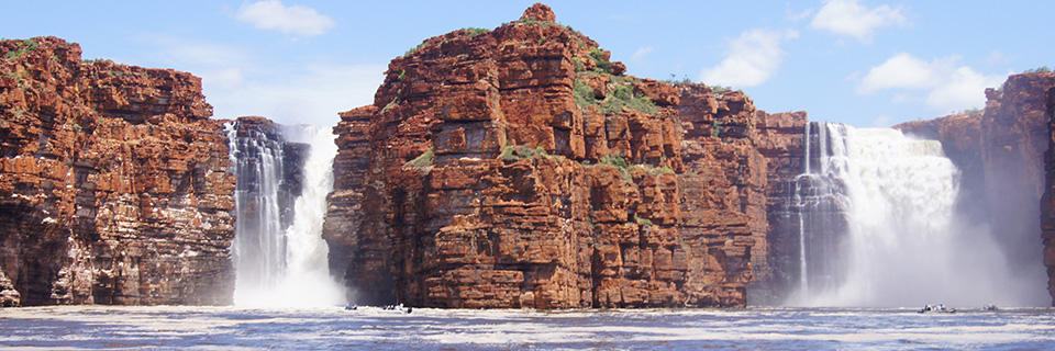
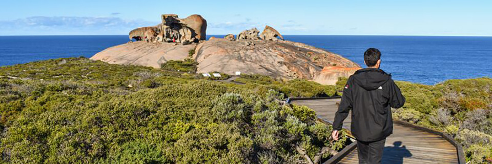
Not only do we take you to some of the most remote and remarkable countries – this Arctic and Greenland expedition being no exception – but our team of highly trained skilled leaders make the journey so very interesting! From taking a Zodiac ride through the impressive icebergs of Disco Bay to learning all about the fascinating Inuit heritage of Nuuk – thought to be 4,000 years old, Silversea’s experts make sure that every moment matters on this trip.

Trip Name
Kangerlussuaq to Kangerlussuaq Expedition (Silver Cloud)
Days
17
Overview
Vessel Type: Luxury Expedition Length: 157 m Passenger Capacity: 200/260 Built: 1994 Refurbished & Rebranded: 2017 
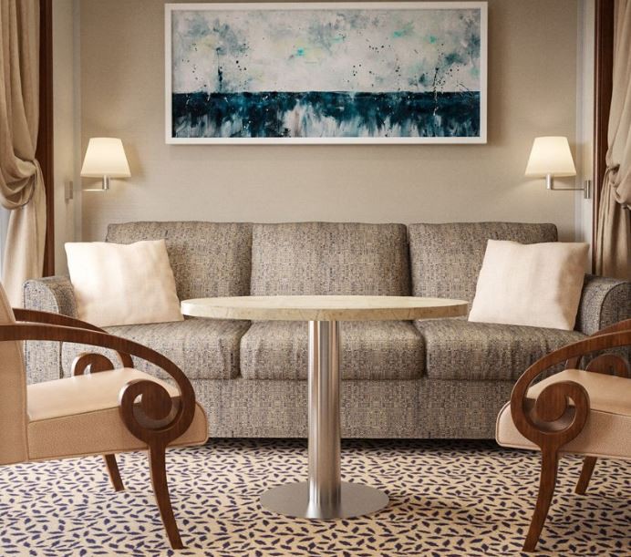
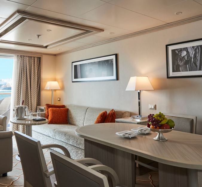
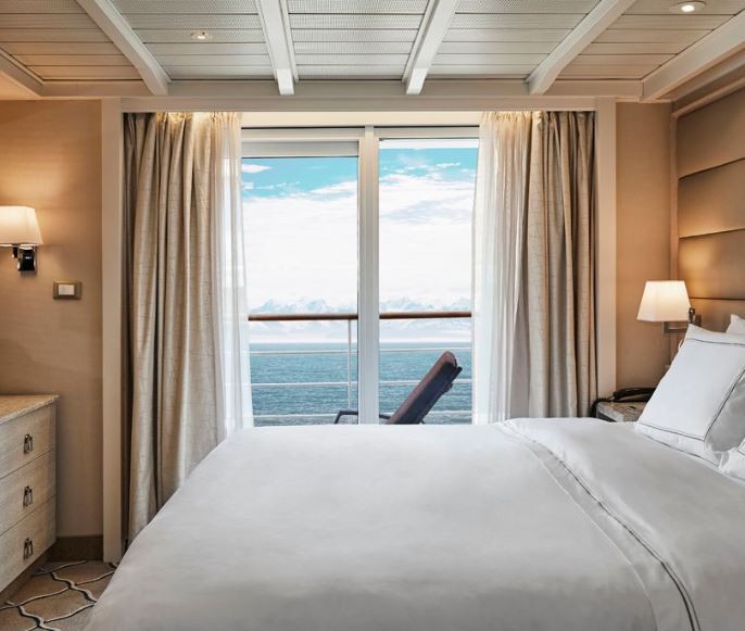
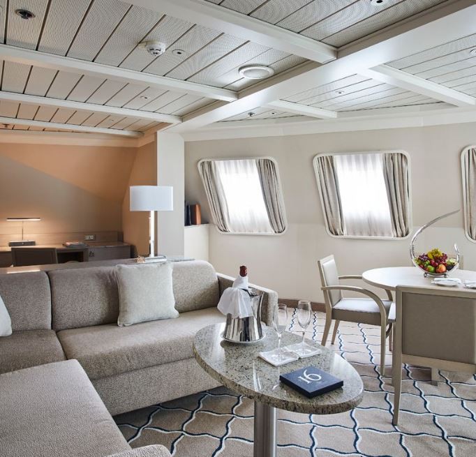
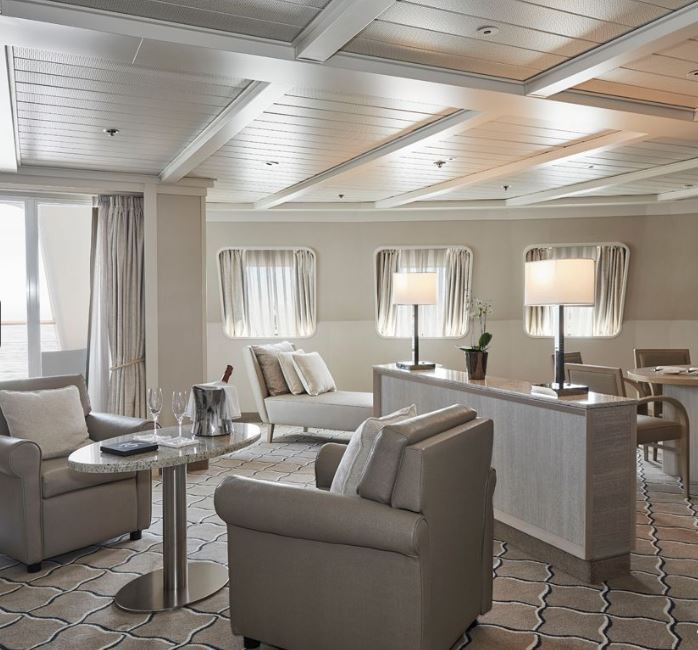
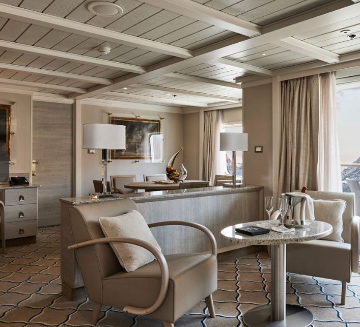
After extensive refurbishment, Silver Cloud will be the most spacious and comfortable ice class vessel in expedition cruising. Her large suites, her destination itineraries and her unparalleled service make her truly special. Her five dining options will tantalise your taste buds and as 80% of her suites include a veranda, watching a breaching whale or a few cavorting penguins has never been so personal. Broad sweeping decks with multiple open spaces and a swimming pool complete what is surely the most distinctive expedition ship sailing today. A limited number of guests, particularly with just 200 in polar waters, mean that Silver Cloud has the highest space to guest and crew to guest ratios in expedition cruising. With her 18 zodiacs, possibilities are almost limitless with ship-wide simultaneous explorations. Finally, a team of 19 passionate and dedicated experts are always at hand to ensure your voyage is enhanced every step of the way. DECK 09 - Observation Lounge, Jogging Track DECK 08 - Pool, Pool Bar, Hot Rocks, The Panorama Lounge, The Connoisseur’s Corner DECK 07 - La Terrazza, The Spa at Silversea, Beauty Salon, The Library DECK 06 - Lecture Theatre, The Fitness Centre, Reception/Guest Relations, Expedition Desk DECK 05 - The Bar, Boutique, Casino DECK 04 - Main Restaurant, Le Champagne, Launderette

Itinerary


Day 1 - Day 1 Kangerlussuaq
Kangerlussuaq is a settlement in western Greenland in the Qeqqata municipality located at the head of the fjord of the same name (Danish: Søndre Strømfjord). It is Greenland's main air transport hub and the site of Greenland's largest commercial airport. The airport dates from American settlement during and after World War II, when the site was known as Bluie West-8 and Sondrestrom Air Base. The Kangerlussuaq area is also home to Greenland's most diverse terrestrial fauna, including muskoxen, caribou, and gyrfalcons. The settlement's economy and population of 512 is almost entirely reliant on the airport and tourist industry.
Day 2 - Day 2 Sermilinnguaq & Maniitsoq
Located in the central part of Greenland’s western coast, Maniitsoq is Greenland’s sixth-largest town, and home to less than 2700 inhabitants. The main attractions are the small museum and old cemetery at the northern end of town. At the community hall local artist and artisans usually exhibit some of their carvings and beadwork. The beadwork pieces are not created just as souvenirs for visitors — the national dress of the West-Greenlandic women uses an elaborately beaded collar. Fishing trips and even heli-skiing on nearby mountains are considered Maniitsoq’s other assets. Its local name (meaning ‘place of rugged terrain’) contrasts somewhat with the name given by the Danish in 1782 (‘New Sugarloaf’).
Day 3 - Day 3 Nuuk (Godthab)
Nuuk, meaning “the cape”, was Greenland’s first town (1728). Started as a fort and later mission and trading post some 240 kilometers south of the Arctic Circle, it is the current capital. Almost 30% of Greenland’s population lives in the town. Not only does Nuuk have great natural beauty in its vicinity, but there are Inuit ruins, Hans Egede’s home, the parliament, and the Church of our Saviour as well. The Greenlandic National Museum has an outstanding collection of Greenlandic traditional dresses, as well as the famous Qilakitsoq mummies. The Katuaq Cultural Center’s building was inspired by the undulating Northern Lights and can house 10% of Nuuk’s inhabitants.
Day 4 - Day 4 At Sea
a:0:{}
Day 5 - Day 5 Iqaluit (Nunavut)
Iqaluit is the capital of Canada’s newest territory, Nunavut, which is Inuktitut for “our land”. The community is located at the head of Frobisher Bay, an inlet of the North Atlantic extending into southeastern Baffin Island. The Bay is so long that it was first taken to be the possible entrance of a Northwest Passage. In Iqaluit, the Nunatta Sunakkutaangit Museum and the Nunavut Legislative Assembly Building both house incredible collections of Inuit artwork with interesting local prints for sale in the museum shop.
Day 6 - Day 6 Lower Savage Islands
The Lower Savage Islands are a small group of islands off of the southeastern tip of Baffin Island, and a common location for polar bears to be found during the summer months. With plenty of land to roam while giving each other a wide berth, plus opportunities to feed, it seems perhaps bears can be found here as the ice vanishes with the summer season’s warming temperatures.
Day 7 - Day 7 Monumental Island & Lady Franklin Island
Monumental Island in Davis Strait was named by Arctic explorer Charles Francis Hall as a tribute to the memory of Sir John Franklin who died in his quest to find the Northwest Passage. The island is offshore of Baffin Island in the Canadian Arctic Archipelago of the territory of Nunavut. Around the shoreline scores of Black Guillemots dive and fish for little Arctic cods and capelins. Successful birds fly off with a minnow grasped tightly in their beaks. On a far larger scale, it is possible to find groups of walruses with their impressive tusks along the shores of the island. However, the coup de grâce is to spot a polar bear’s white silhouette against the dark background of the bedrock on Monumental Island.Named in honour of Sir John Franklin’s widow, the lonely and uninhabited Lady Franklin Island lies off of Baffin Island’s Hall Peninsula at the entrance to Cumberland Sound. The island is named for the wife of Sir John Franklin, the Arctic explorer who died trying to discover the Northwest Passage. The geology of the island is striking with vertical cliffs of Archean rocks, likely to be some of the oldest stone in Canada. The waters around Lady Franklin Island offer an abundance seabirds, ducks, seals, and walrus. With a bit of luck it is possible to see Atlantic Puffins here and perhaps even a rare Sabine’s Gull.
Day 8 - Day 8 At Sea
a:0:{}
Day 9 - Day 9 Isabella Bay (Nunavut)
The shoreline and islands of Isabella Bay, as well as the adjacent ocean out to 12 nautical miles from shore, was folded into Canada’s Ninginganiq National Wildlife Area in 2010. Located on the northeast coast of Baffin Island, Nunavut, Isabella Bay provides important marine habitat for bowhead whales, other marine mammals, and a plethora of seabirds. As a result of the formation of the Ninginganiq National Wildlife Area the eastern bowhead population may now be over 10,000 individuals.
Day 10 - Day 10 Sam Ford Fjord (Nunavut)
The starkly beautiful Sam Ford Fjord area of Baffin Island has one of the most impressive concentrations of vertical rock walls to be found anywhere in the world. It is a 110-kilometer (68-mile) waterway lined with sheer cliffs that have attracted some of the world’s best (and most extreme) rock climbers to the region. The steep stone walls were formed by ancient glaciers that carved the landscape through the ages. However, the feature that makes the shoreline truly special is the way that many of these walls rise straight up from the dark waters of the deep fjord. Swimming these waters are marine mammals including narwhals and seals that once attracted Inuit hunters to this coast.
Day 11 - Day 11 Gibbs Fjord (Nunavut)
There are few places on earth where the simple grandeur of the landscape can dwarf a ship with giant peaks, steep cliffs, and glacial rivers of ice. In Gibbs Fjord it is possible to see only towering cliffs and the seemingly impenetrable fortress of 4,000-foot walls and buttresses that make up Sillem Island, eventually dividing the dark, deep waters of Gibbs and Clark Fjords. The geological formations here make for excellent photo opportunities and it is astounding to realize that very little of this spectacular terrain has ever been explored.
Day 12 - Day 12 At Sea
a:0:{}
Day 13 - Day 13 Upernavik (Avannaata)
More than 1,100 inhabitants presently make the small town of Upernavik their home. The name in Kalaallisut means “Springtime Place” and is also given to the island upon which the town rests. This small settlement was founded in 1772, and is the northernmost town in Greenland with a population of over 1,000. The Upernavik Museum is the oldest in Greenland and houses a collection of local art. In 1824, the Kingittorsuaq Runestone was found outside the town. In addition to the runic characters left here by Norsemen, probably from the late 13th century, Norse artifacts have been found in the area, likely marking the northern limit of Viking exploration.
Day 14 - Day 14 Qeqertarsuaq
During the morning Silver Cloud will ply the Disko Bay en route to our destination along Disko Island’s east coast. Our exploration of the Disko Bay area will head to an area north of the village of Qeqertarsuaq, which is named after Disko Island’s local name –meaning “large island”. With more than 3,300 sq. miles Disko Island is Greenland’s second-largest island.
Day 15 - Day 15 Ilulissat
Known as the birthplace of icebergs, the Ilulissat Icefjord produces nearly 20 million tons of ice each day. In fact, the word Ilulissat means “icebergs” in the Kalaallisut language. The town of Ilulissat is known for its long periods of calm and settled weather, but the climate tends to be cold due to its proximity to the fjord. Approximately 4,500 people live in Ilulissat, the third-largest town in Greenland after Nuuk and Sisimiut. Some people here estimate that there are nearly as many sled dogs as human beings living in the town that also boasts a local history museum located in the former home of Greenlandic folk hero and famed polar explorer Knud Rasmussen.
Day 16 - Day 16 At Sea
a:0:{}
Day 17 - Day 17 Kangerlussuaq
Kangerlussuaq is a settlement in western Greenland in the Qeqqata municipality located at the head of the fjord of the same name (Danish: Søndre Strømfjord). It is Greenland's main air transport hub and the site of Greenland's largest commercial airport. The airport dates from American settlement during and after World War II, when the site was known as Bluie West-8 and Sondrestrom Air Base. The Kangerlussuaq area is also home to Greenland's most diverse terrestrial fauna, including muskoxen, caribou, and gyrfalcons. The settlement's economy and population of 512 is almost entirely reliant on the airport and tourist industry.
Day 18 - Please Note:
Itineraries are subject to change.

Trip Dates

StartEndPrice FromRoom Type

Inclusions

    • Learn about the history of Greenlandic and Canadian Inuit communities and experience how modern descendants live in small villages in these modern times.
    • Look for Inuit art in Greenland and in Nunavut, which claims to have more artists per capita than any other part in the world.
    • Glaucous Gull, Iceland Gull, Common Gull, Great Black-backed Gull, Arctic Tern, Black-legged Kittiwakes, Northern Fulmars, Black Guillemots, Greater Snow Goose, Ravens, Common Redpoll, Snow Bunting, Lapland Bunting, Ringed, bearded and harp seals, walrus Polar bears can be seen in the region, Minke, bowhead, beluga and humpback whales, narwhals

Map